A rather provocative title, and I actually didn't want to write a post about this short tour. However, the Ellhorn in Mäls in Liechtenstein is so incrediblyBeautiful, and even though the tour was short, the impressions were phenomenal. Of course, I don't want to keep these from you, so I've put a few snapshots into a gallery.
Starting point
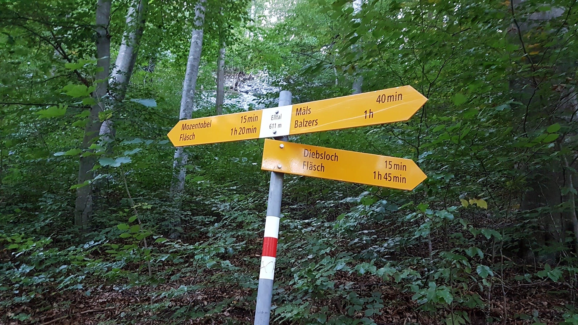
From the small, idyllic village of Mäls, located at the lower end of Liechtenstein, I walk across meadows and fields towards Ellhorn. It's a small hill that I've wanted to climb for quite some years. The summit is at approximately 750 meters above sea level. Today, I've finally tackled the Ellhorn project. Following the signpost towards Elltal, I ascend via a type of forest road. The path later merges into a small hiking trail at a large lumberyard. From there, it's only a few meters until you reach the ridge trail. It's important to always keep heading upwards. The path occasionally turns straight ahead.
View
The view from the summit is breathtaking. You look straight at the Gonzen and the Sarganserland. The Rhine currently has less water and you can see the sandbanks. I'm eating dinner up here and enjoying the view.
Way back
Further along the hike, there are several options. I decided to walk back down to Mäls through the Elltal. Passing some mountain huts and startling a couple of grazing deer, you arrive back in the village after about 30 minutes. This was a good thing, as it was already getting dark, as you can see in the pictures below.
As an alternative, you can go down through the Mozentobel on the other side to the Rhine. Below the Ellhorn, you can then walk towards Mäls. Next time I'll take this route, which is surely also worth seeing.
Conclusion
The Ellhorn in Mäls is a beautiful short hike. Ideal for after work or if you only have an afternoon free. The view is magnificent and worth every meter gained. With children, you should be careful at the top, as the rocks are very steep. So it's better to keep children on a leash 🙂
Information about the tour
- Directions Mals in Liechtenstein, alternatively one can start running from Balzers
- Walking distance 4.92 kilometers
- Hiking time 1:43 h (including taking photos and breaks)
- Elevation gain: Estimated approx. 350 m
- Meters of descent: approximately 350 m
- Difficulty level: Light
- Requirements Sturdy footwear
On the page of Liechtenstein Tourism you can find further information and tour suggestions.


- About the Author
- Latest posts

On my travel blog Wandernotizen I'll take you along on our family trips around the globe. Between wanderlust and everyday chaos, you'll find honest travel reports, tips, and plenty of material to ignite your wanderlust. 🧭 ❤️ 🏝️