A beautiful and at the same time very demanding hike is the trail from Zizers to Valzeina, in Prättigau. I describe the hike to Valzeina as demanding because it
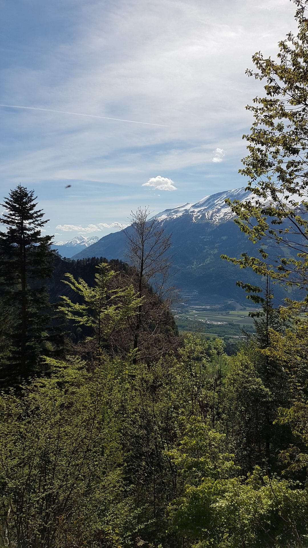
It goes steeply uphill from the beginning until shortly before the end. But in return, you walk through great forests and get a clear view of the Churer Rheintal every now and then. I started in Zizers and then walked on Igiserstrasse to Igis until you reach the Volg. From there, you turn right and just keep walking straight up... and up... and up... and up =)
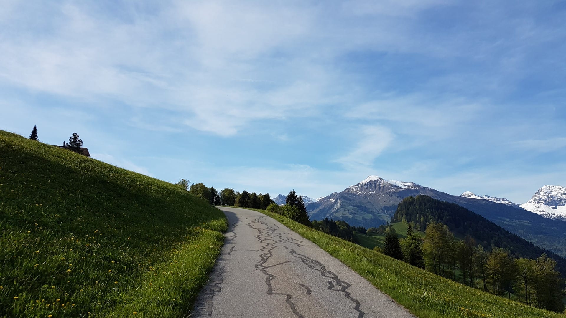
Once you're out of town, you pass through open and (for now at least) green meadows, leave a farm or two behind on the left and right, and walk into a beautiful mixed forest. Unfortunately, Valzeina isn't signposted too often, but you can't miss it if you just keep walking uphill. You'll inevitably end up on the right path (great thing). *g*
Passing by beautiful gorges, ravines, and streams, you reach a small forest road again. You can now follow its course or take the shortcuts, which always lead back to the road. After 3.77 km, the road ends and merges into a mountain hiking trail. From here, it goes steeply uphill.
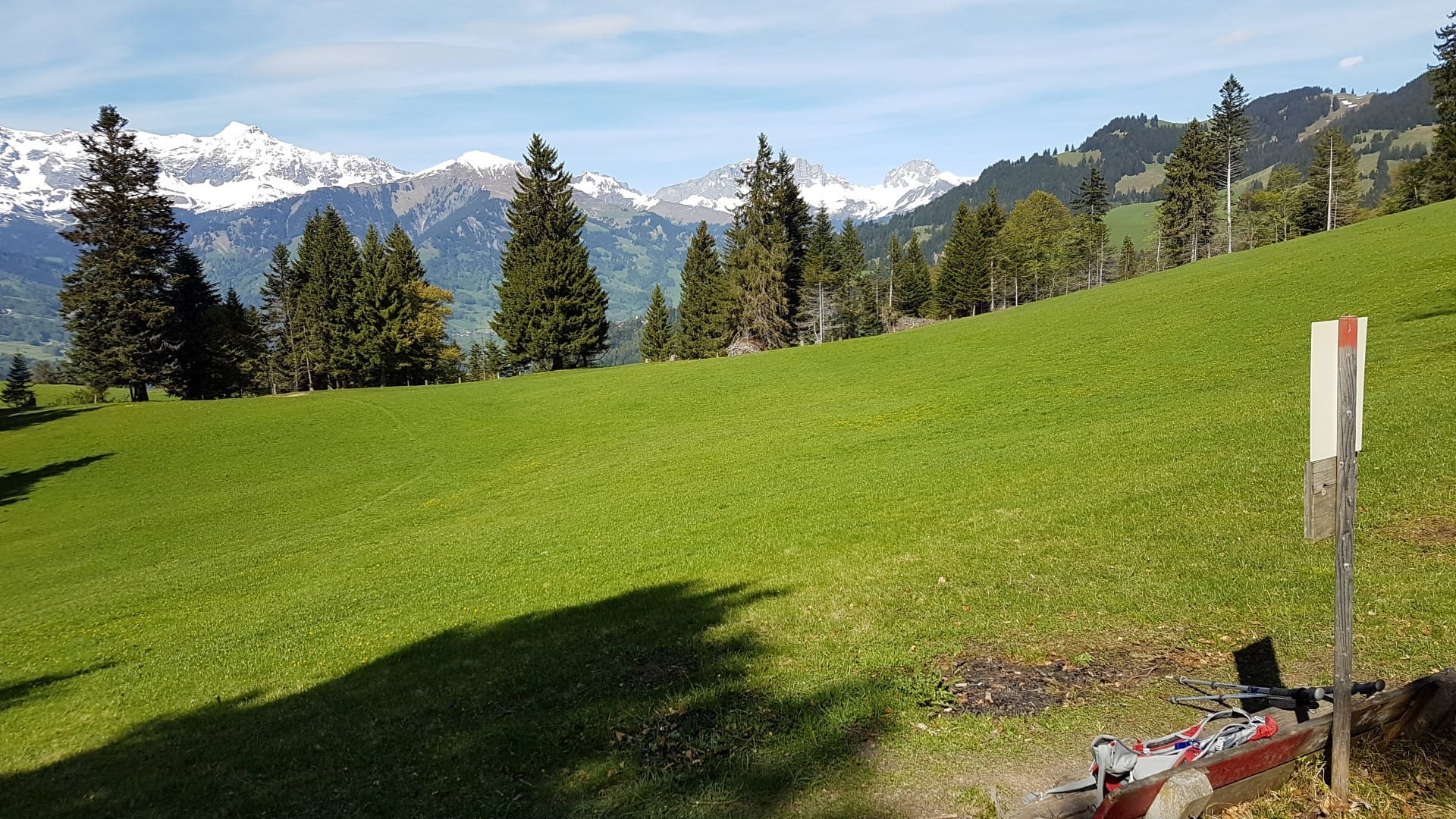
After about 2 hours, you reach Sturnaboden at an altitude of 1358 m. The vast meadows invite you to take a leisurely break. What's fantastic up there is the peace and quiet, as you are now on the other side of the mountain and can no longer hear the traffic in the Rhine Valley.
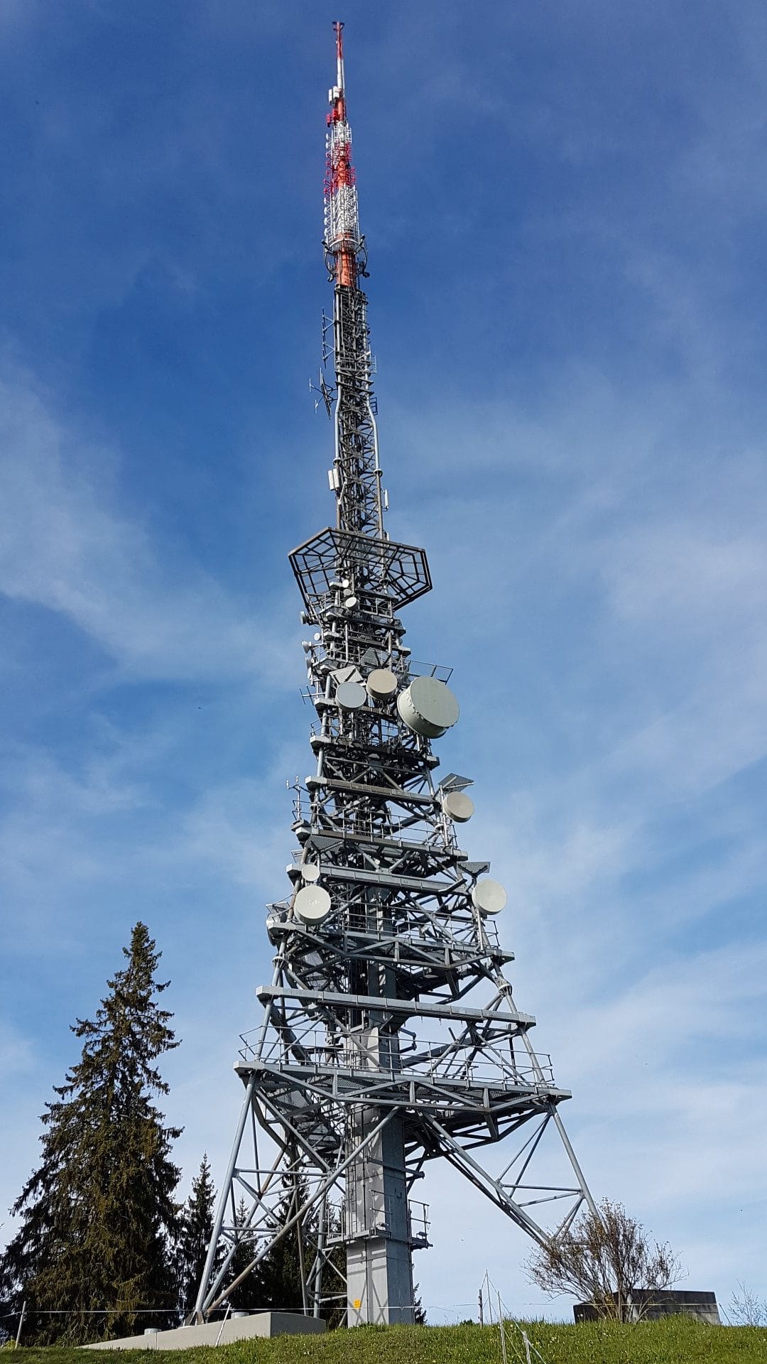
Since you can see the Swisscom tower in Valzeina from Zizers, this was my actual goal, so I naturally made a short detour there. It looks a bit like the Eiffel Tower (of Switzerland). The size of the tower is fascinating, and the exceptionally good cell phone reception there, hahaha…
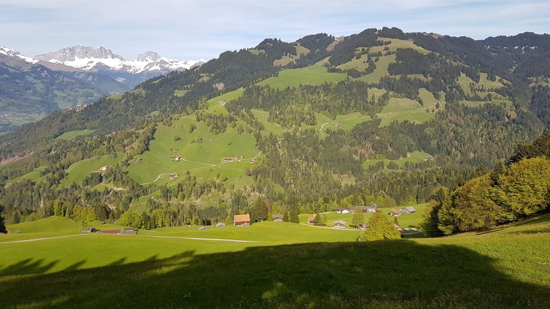
But now we continued to Valzeina, a community of 140 souls. A larger farm sits enthroned above the village, and right behind it, the Flüeli asylum center *g* The idyllic setting and mountain backdrop up there are breathtaking. However, it was also a sad sight at the same time. From this center, which serves as an deportation center, you walk about 200 meters in elevation and 1.5 km to the next bus stop. Ouch... and this bus only runs four times a day to the next town, where there are shops. Quite a dire situation up there.
Anyway, for me it was now exactly down this street to Valzeina, where my taxi was waiting 🙂
The drive down to Landquart was adventurous but we survived lol
- Directions Bus stop Zizers, picture or train station, or Igis
- Walking distance 9.09 km
- Hiking time 3:42 h (including taking photos and breaks)
- Elevation gain: 827 m
- Meters of descent: 244 m
- Difficulty level: Center
- Requirements Good hiking boots, good condition


- About the Author
- Latest posts

On my travel blog Wandernotizen I'll take you along on our family trips around the globe. Between wanderlust and everyday chaos, you'll find honest travel reports, tips, and plenty of material to ignite your wanderlust. 🧭 ❤️ 🏝️