In the heart of Canton Glarus lies a hiking area that more than lives up to the title "Hiking in Klöntal." What we consider the Scandinavia
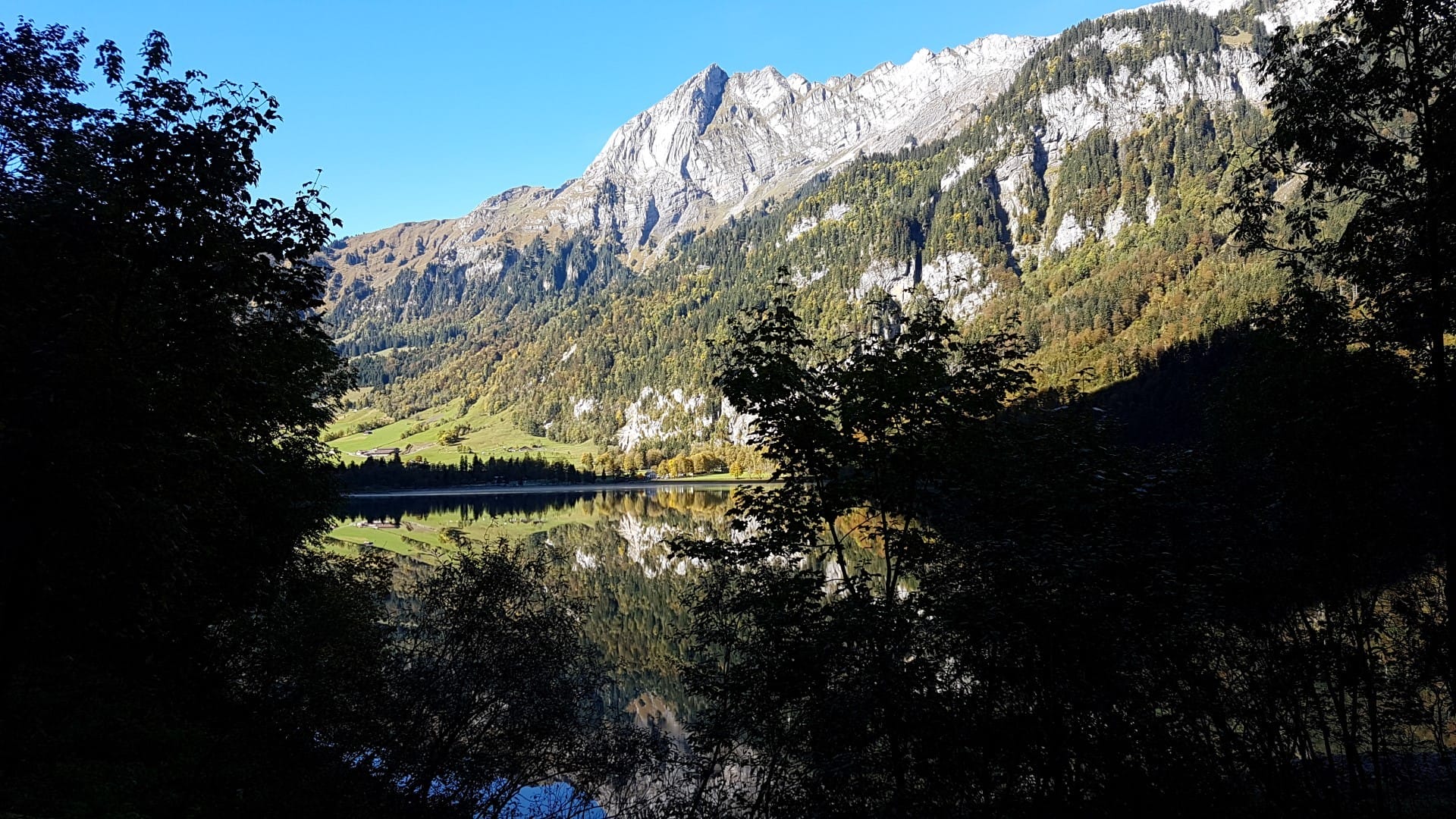
The Klöntalersee, located at 851 meters above sea level and surrounded by mountains, is a true highlight of what our region in Switzerland has to offer. It's an impressive landscape not only for tourists from the lowlands but also for those lowlanders who have been living here for years.
Anyway, I've been to the Klöntal several times now and can highly recommend this excursion destination. It's a shame that it's now approaching winter. From October 31st, the restaurants there will also be partially closed already. In winter, access to the valley is simply difficult, but next summer is sure to come, so I don't want to withhold these tips from you for next year.
Directions
You can easily reach Glarus via the A3 motorway coming from Basel/Zurich, as well as from Chur and naturally from other directions. Those coming from Central Switzerland can take the route via the Klausen Pass. This route is sensational and much more exciting than the motorway.
The Klöntalerstrasse leads to the Klöntalersee, who would have thought. =)
Alternatively, you can of course leave the car at home and travel by public transport. The bus stop is called Rhodannenberg.
Hiking start point
You now have two options here. Either you start at the lake up top or down below. We usually start down below, meaning at the Hotel Restaurant Rhodannenberg. You can drive straight over the dam there, and there are parking spots right behind it. A small special feature is the parking meter. It's located directly on the dam. There aren't any more after that 🙂
Beware: Don't park on the street where the others park. That costs 40 CHF *lol*
But what makes the Klöntal so special, or rather, hiking in the Klöntal? It's simply the surroundings. Only a small road runs alongside the lake. For the panoramic hike, you walk on the opposite side. This hiking trail mostly leads through the forest, along the shore.
Waypoints
Along the riverside path itself, you'll repeatedly find numerous barbecue areas or simply beautiful spots that invite you to linger. Equally numerous are small streams that cross the hiking trail. These mostly carry water in the spring.
Immediately after the Darlibach, the wider, paved path ends and turns into a narrow hiking trail. There, you can take a short detour to the monument of the Zurich poet and painter Salomon Gessner. The path is continuously strewn with stones and roots and also becomes narrower and steeper here and there. There are then safety ropes for support.
After about two hours, you reach a wide stream delta. In spring, there's an impressive waterfall there, which unfortunately wasn't visible this time. But the detour is still worth it. Especially in summer, the air there is pleasantly cool.
After another approximately 20 minutes, you reach the Vorauen campsite and the Vorauen restaurant. Anyone who needs a small refreshment can enjoy good local and seasonal food here. Directly opposite is a bus stop that takes you back to the Rhodannenberg restaurant.
Of course, you can also walk back. It's less fun across the street, but it's also a nice route.
Information about the tour
- Directions A3, Glarus exit or public transport alternatively
- Walking distance 5.39 miles (one side)
- Hiking time 2h 43m (including taking photos and breaks)
- Elevation gain: 70 m
- Meters of descent: 70 m
- Difficulty level: Light
- Requirements Sturdy footwear, sure-footedness


")


- About the Author
- Latest posts

On my travel blog Wandernotizen I'll take you along on our family trips around the globe. Between wanderlust and everyday chaos, you'll find honest travel reports, tips, and plenty of material to ignite your wanderlust. 🧭 ❤️ 🏝️